Calculating dredging volume for the Pentwater (MI) channel
July 22, 2013
David Roseman
Data were captured using an SD card in a Garmin 441s fishfinder. The resulting .adm file was imported into Garmin HomePort, then exported as a gpx file.
The gpx file was imported into UnderSee Explorer, which generated a contour map.
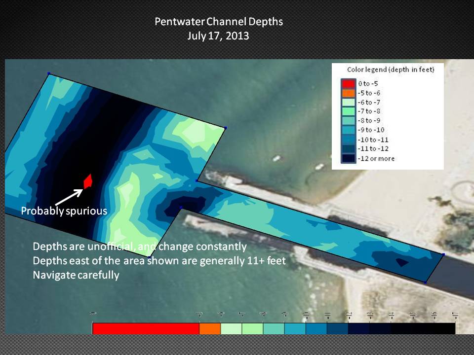
This map was exported as a kmz file, which was imported into Google Earth Pro. Polygons were traced in the area to be dredged, at 1' intervals.
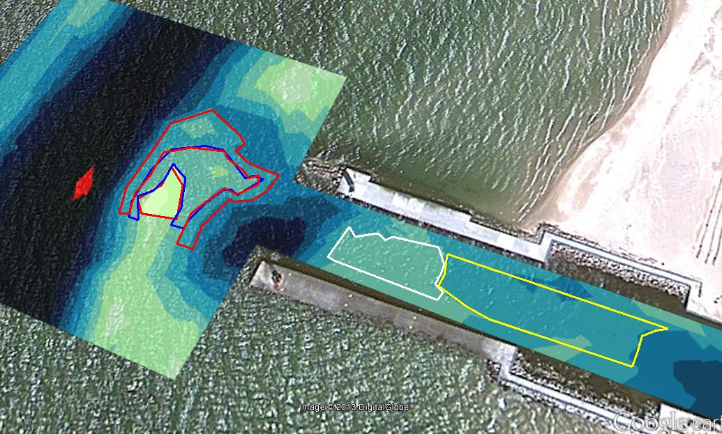
The area of each polygon was read in square yards, and entered into a spreadsheet. The area was divided by 3, to find the volume in 1 foot of bottom. The polygons were combined to give the total volume to be dredged at 1 foot intervals.
| location |
present depth |
area (sq yds) |
| sandbar |
6.5 |
40.3 |
| sandbar |
7.5 |
1377 |
| sandbar |
8.5 |
1749 |
| channel |
8.5 |
1165 |
| channel |
9.5 |
2194 |
| both |
10.5 |
6525.3 |
| dredged depth (feet) |
volume (cu yds) |
| 8 |
472 |
| 9 |
1443 |
| 10 |
2175 |
| 11 |
4350 |